

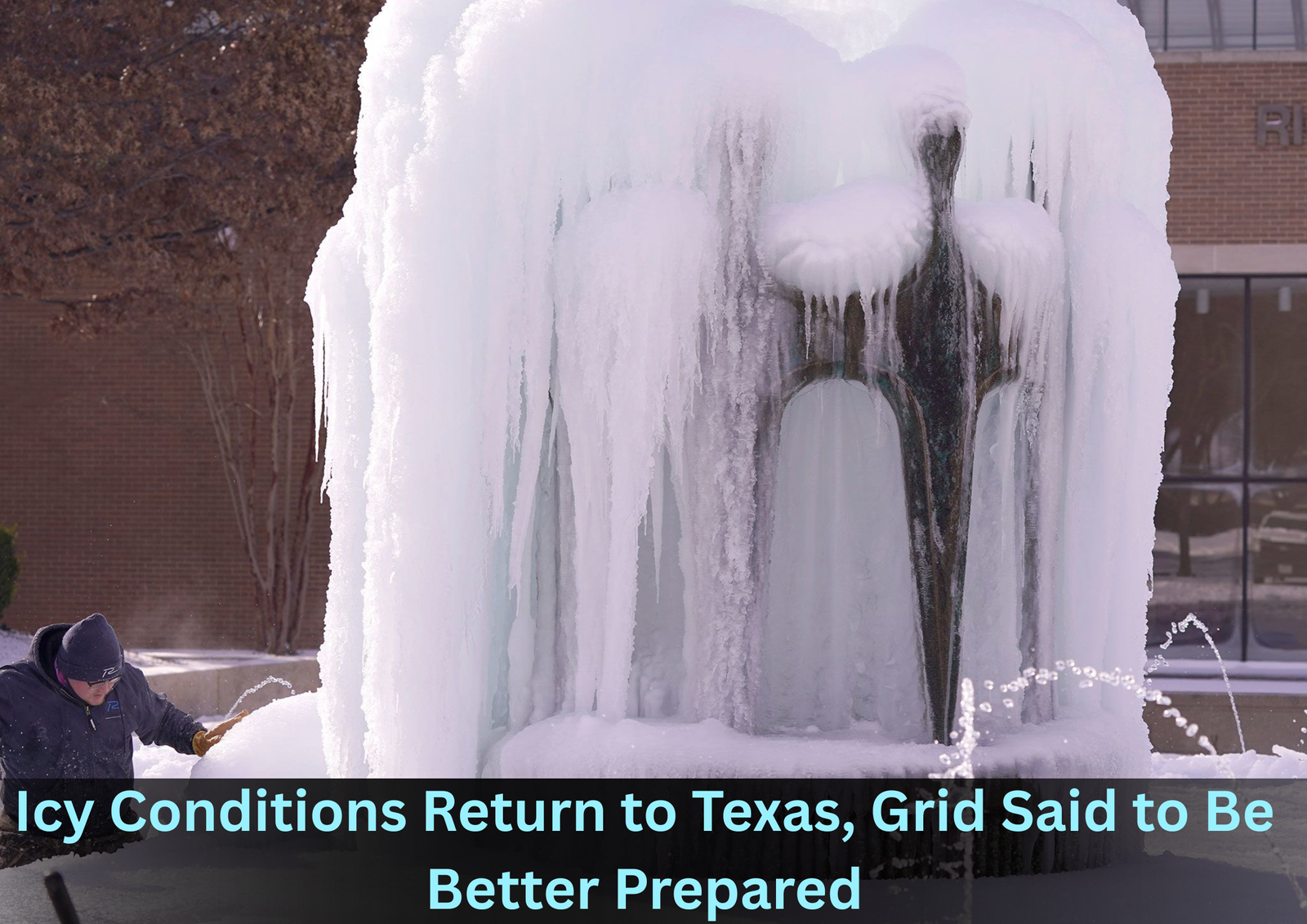
A developing winter weather system is expected to affect large parts of Texas this weekend, raising concerns about freezing rain, slick roads, and travel disruptions-particularly across Central Texas. Meteorologists and state officials, however, are emphasizing that the approaching storm differs significantly from the devastating cold wave that struck the state in February 2021.
Forecast models indicate that an Arctic front will move into the region late Friday, introducing colder air that could overlap with incoming moisture. This interaction is expected to produce freezing rain and light sleet from Saturday through early Sunday, primarily impacting areas around Austin and San Antonio.
According to the National Weather Service, Central Texas currently has the highest likelihood of seeing ice accumulation. While snowfall is not expected to be widespread, even small amounts of ice could create hazardous driving conditions, especially on bridges and elevated roadways.
Meteorologists are also working to clarify comparisons being made to the historic 2021 freeze. Travis Herzog, chief meteorologist, stated that this event should not be viewed as a repeat of that disaster. He explained that the earlier crisis involved several days of intense and sustained Arctic cold that overwhelmed power infrastructure statewide. By contrast, this weekend’s system is forecast to be shorter in duration and less severe in terms of temperature extremes.
In the Houston area, weather conditions are expected to evolve in stages. Midweek storms, including showers and thunderstorms, are forecast ahead of the colder air. As temperatures drop later in the weekend, areas north of the city could face a risk of freezing rain, though widespread ice is not currently expected within the metro itself.
San Antonio officials noted that the city sits near the western edge of the projected ice zone. Even so, they cautioned residents not to underestimate the impact of light ice, which can quickly lead to accidents and traffic delays. Austin-area forecasts suggest rain may begin Friday before transitioning to freezing rain as temperatures fall overnight into Saturday.
Across the region, emergency planners are urging residents to stay informed as forecasts are refined. While large-scale power failures are not anticipated, isolated outages remain possible if ice accumulates on trees or power lines.
Authorities stress that preparation remains important. Drivers are advised to limit unnecessary travel during icy periods, and households are encouraged to have essential supplies on hand. Officials continue to monitor the storm closely, reiterating that while this system poses real risks, it is not expected to produce the prolonged, grid-disrupting conditions seen in 2021.
Don’t miss the full story behind “Chicago Jury Clears Man in Alleged Murder-for-Hire Case Involving Border Patrol Official”-read this blog for key details, courtroom twists, and what the verdict really means.